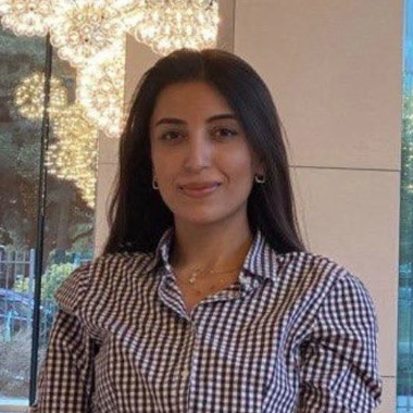
School of Design and Architecture

Dina Jovanovic Lombardo
Visiting Assistant Professor
Architecture and Design
Email:
Office:
Joined ADA:
dlombardo@ada.edu.az
A404
2025
COURSES
- Basics of Representation and Survey
- Drawing Studio for Interior Design
EDUCATION
- PhD, Politecnico di Milano
- MSc, Politecnico di Milano
- BA, University of Belgrade
PUBLICATIONS
-
Oreni, D., Jovanovic, D., & Barazzetti, L. (2025). Digital Recording of the Domus of Arianna in Pompeii: Toward a HBIM Platform for Site Management. In DH2025-Digital Heritage International Congress 2025. Eurographics-The European Association for Computer Graphics.
-
Jovanović, D. & Oreni, D. (2025). Geometric Analysis of Palazzo Sormani’s Vault through Drawings, Historical Manuals, and 3D Modelling. Proceedings at Èkphrasis - 46th International Conference of Representation Disciplines Teachers Congress of Unione Italiana per il Disegno, 1681-1690.
-
Jovanović, D. & Oreni, D. (2024). Reevaluating Historical Road Connections Through Historical Cartography. International Conference on Visualizing Landscape. July 11-12, 2024, Alghero, Sardegna.PUBLICA, 738-753.
-
Garramone, M., Jovanovic, D., Oreni, D., Barazzetti, L., Previtali, M., Roncoroni, F., Mandelli, A., & Scaioni, M. (2023). Basilica di San Giacomo in Como (Italy): Drawings and HBIM to Manage Archeological, Conservative and Structural Activities. The International Archives of the Photogrammetry, Remote Sensing and Spatial Information Sciences, XLVIII-M-2-2023, 653–660.
-
Gaspari, F., Stucchi, L., Bratic, G., Jovanovic, D., Ponti, C., Biagi, L. G. A., & Brovelli, M. A. (2021). Innovation in Teaching: The Polimappers Collaborative and Humanitarian Mapping Course at Politecnico Di Milano. The International Archives of the Photogrammetry, Remote Sensing and Spatial Information Sciences, XLVI-4/W2-2021, 63–39.
-
Jovanovic, S., Jovanovic, D., Bratic, G., & Brovelli, M. A. (2019). Analysis of free road data in Tanzania, Uganda and Kenya using free and open source software. The International Archives of the Photogrammetry, Remote Sensing and Spatial Information Sciences, 42, 1567–1572.
-
Jovanović, D. (2022). From QGIS to Python: Comparison of Free and Open Tools for Statistical Analysis of Cultural Heritage and Data Representation The International Archives of the Photogrammetry, Remote Sensing and Spatial Information Sciences, XLVIII-4/W1-2022, 229–236.
-
Jovanović, D. & Oreni, D. Diverse Uses of Historical Cartography: From Urban Analysis to the Educational Tool. 15th The International Cartographic Association (ICA) Conference, Commission on Cartographic Heritage into the Digital. 6-7 May 2021, ELTE Eötvös Loránd University, Budapest,Hungary. Conference Proceedings (ISSN 2459-3893) by CartoGeoLab, AUTH - Aristotle University of Thessaloniki, Greece: 218-231.
-
Jovanović, D. & Oreni, D. (2021). The Methodology to Systematize, Present and Use Historical Cartography: Potentials and Limits to Analyze and Enhance Widespread Historical Centres in Northern Italy. 28th CIPA Symposium, 28 August–1 September 2021, Beijing, China. The International Archives of the Photogrammetry, Remote Sensing and Spatial Information Sciences, V. XLVI-M-1-2021: 339-346.
-
Jovanović, D., & Oreni, D. (2022). Sifting Through Historical Maps. Methodology for the Implementation of Cartographic Content in Urban Planning: Case Study of Desio. The 22nd International Conference on Computational Science and Its Applications - ICCSA 2022, Malaga, Spain: 165-180.
-
Jovanovic, D., & Oreni, D. (2023). Drawings for the Reuse of Nineteenth Century Greenhouses in the Garden of Villa Cicogna Mozzoni. International Archives of the Photogrammetry, Remote Sensing and Spatial Information Sciences, 48, 783–790.
-
Jovanovic, D., Oreni, D., Della Torre, S., & Moioli, R. (2021). Analysis of historical cartography and data presentation for an educational purpose: The case of the historical centre of Vimercate. Proceedings of the International Cartographic Association, IV, 1–8.

 EN
EN


